


Acadia National Park GPS Tour
4.116.00 Reviews
App Specs
- Version
- 1.66
- Updated On
- License
- Free
- Downloads
- 10,000+
- Developer
- Action Tour Guide LLC
- Categories
- Travel & Local
- Platform
- Android
Screenshots
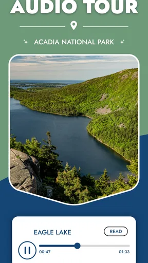
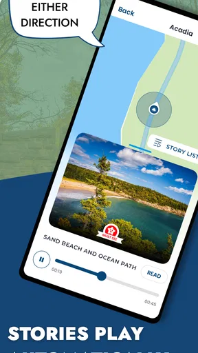
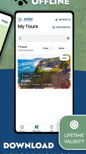
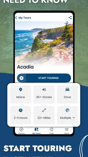


 Analysis by AppCompare
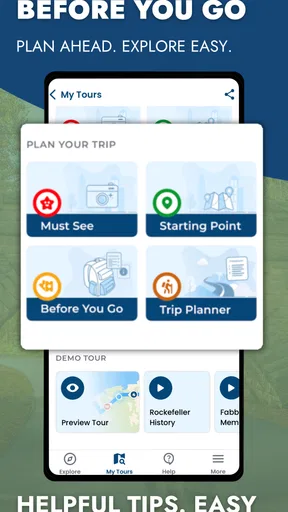
Acadia National Park GPS Tour is the kind of travel app I appreciate most when I am trying to keep my attention on the landscape instead of on a screen. It turns a visit to Acadia National Park into a self-guided audio experience, using GPS, maps, scenic trails, and popular viewpoints to give the day some structure. I found it more useful than a simple list of places because it connects movement through the park with spoken guidance, while still leaving me in control of the pace.
The app is free to install and belongs to the Travel & Local category. It is made by Action Tour Guide LLC, carries an Everyone age rating, and has a 4.1 average from around 68 ratings, with over 10K installs. Those figures suggest a modest but established audience rather than a huge travel platform, which fits the experience: this feels like a focused guide for a particular destination, not a full trip-planning suite.
How I would use it during a day in Acadia
My preferred workflow starts before leaving for a trail or viewpoint. I would open the app while connected to reliable internet, look over the map, and identify the parts of Acadia I genuinely want to visit. That small preparation matters because a national park day can become fragmented very quickly. Without a plan, I might jump between viewpoints, miss a turn, or spend more time deciding where to go than enjoying the scenery.
The basic experience is straightforward: use the map to understand the route, move through the park, and listen to the audio guidance as the GPS position changes. The attraction is not simply hearing facts. It is having context arrive while I am near the relevant landscape. That makes the tour feel more natural than reading a long guidebook entry in the car or stopping repeatedly to search for information.
I would treat the audio as a companion rather than a strict itinerary. If a viewpoint is crowded, weather changes, or a family member needs a break, I can pause the tour and continue later. That flexibility is important for Acadia, where a scenic stop can take two minutes or half an hour depending on light, wind, queues, and how much time I want for photographs.
The most useful habit is to prepare the route before the visit, then let the app handle the reminders while I am moving. This avoids the common mistake of trying to discover every option from a small phone screen in the middle of a busy park. It also makes the guide more comfortable for groups, because one person can manage the route while everyone else looks outward instead of gathering around a display.
Offline planning changes the practical experience
The offline capability is one of the strongest reasons to consider this guide. A park visit is not the same as walking through a city with dependable mobile coverage. Even when a phone shows a signal, it may not remain stable along every road, trail, or overlook. I would download or prepare the tour before setting out, check that the map and audio are ready, and avoid assuming that the first stop will be the best place to solve a connection problem.
Worth Reading Before You Choose

Flipboard Shows What News Apps Must Do Beyond the Feed

Switching to Android Auto Means Rethinking Your Driving Routine

Google Calendar Makes a Crowded Week Easier to Manage

Ludo King Makes the Most of the Minutes Between Plans

Baby Panda World Brings Quick Play to Modern Phones, but Its Game Library Feels Busy

ESPN’s Live Game View Makes Following Close Games Easier
This is also useful for conserving attention and battery. Constantly searching online for the next landmark can keep the screen awake and encourage repeated map loading. An offline-first routine lets me glance at the route when needed, then put the phone away. I would still bring a charged phone and a backup plan, because an app should support outdoor navigation rather than replace sensible preparation, posted signs, or local instructions.
There is a subtle trade-off here. Offline guidance is convenient, but it requires a little discipline before departure. A user who installs the app in the parking area and expects everything to work immediately may have a less smooth start than someone who prepares at home or at the hotel. I see that as a manageable friction, especially when the benefit is less dependence on a live connection.
Settings I would check before pressing play
I would begin with the phone’s sound level and notification behavior. Audio tours are easy to miss when navigation alerts, calls, messages, or music compete with the narration. I would choose a volume that remains clear without becoming uncomfortable, then consider whether temporary notification control would make the visit less distracting. This is not a glamorous setting, but it has more impact on the experience than endlessly adjusting the map.
I would also check battery use before the day begins. GPS, an active display, audio playback, photographs, and occasional map checks can all draw power. My practical approach would be to lower screen brightness, lock the display whenever I am not checking the route, and carry a power bank if I expect a long outing. The app’s value depends on being available at the moment I need it, so battery management is part of using it well.
Headphones deserve some thought. They can make narration easier to hear, but I would not use them in a way that blocks awareness of vehicles, cyclists, other visitors, or changing trail conditions. For a group, playing the audio quietly from the phone may be more social, while a single listener may prefer one earbud. The right choice depends on the setting, and safety should come before hearing every sentence perfectly.
I would check the map orientation and zoom level before starting. A very close view can make the route feel confusing when I am actually moving between larger areas, while a very distant view may hide the detail needed for a short walk. Experienced use is less about staring at the map continuously and more about choosing a useful level, listening for the next point of interest, and checking position only when the surroundings do not make the route obvious.
The app has a free entry point, but in-app purchases range from $1.99 to $69.99 per item. I would therefore review what is available inside the app before committing to a paid tour or additional content. The sensible approach is to understand which portion fits my planned visit, rather than buying impulsively because I am already standing at a scenic stop. A free installation makes it easy to explore, but the purchase screen still deserves the same attention I would give any travel expense.
Faster patterns for repeat visitors and busy days
On a first visit, I would listen more fully and allow the guide to shape the rhythm of the day. On a repeat visit, I would use it more selectively. I might revisit only the viewpoints I missed, use the map to orient myself, and listen to the sections that add context to places I already know. That makes the app less like a one-time audio program and more like a reusable reference for different kinds of outings.
A useful pattern for families is to divide the day into short listening periods. Children may not want a continuous stream of narration, while adults may appreciate having background information ready at the right place. I would play a segment near a landmark, pause when the group wants to explore, and resume only when everyone is ready. This prevents the guide from turning into another schedule that the family has to obey.
For photographers, the map and viewpoint emphasis can support a deliberate scouting routine. I would use the route to identify likely stops, then leave enough time for light, composition, and changing weather instead of rushing from one audio trigger to the next. The app can provide location-based context, but it cannot decide whether a particular morning, cloud pattern, or tide suits the photograph I want. That is where personal judgment remains more important than automation.
For someone visiting on a tight schedule, I would choose a small number of priorities before opening the tour. The temptation with any map-based guide is to treat every marked place as mandatory. That usually creates a hurried day. A better method is to select a few scenic trails or viewpoints, use the audio to enrich those stops, and accept that a focused visit can be more satisfying than trying to cover everything.
Another practical shortcut is to keep a simple mental sequence: confirm the next destination, start or resume the audio, put the phone away, and reassess only when the environment calls for it. This reduces the repeated unlocking and map-checking that makes outdoor apps feel intrusive. It also helps preserve the sense that I am visiting Acadia, not merely completing a digital route.
Where this guide is stronger than usual alternatives
The usual alternatives each solve a different problem. A standard map app is excellent for reaching a destination and checking roads, but it rarely provides a connected, location-aware story about the park. A printed guide is dependable and easy to share, yet it requires me to stop and read. A general travel website can offer broad planning ideas, but it is less convenient once I am already moving between viewpoints.
Acadia National Park GPS Tour sits between those choices. Its advantage is the combination of a map, GPS-based guidance, offline use, and spoken information aimed at a single national park. I do not need to keep searching for the next article or decide which paragraph applies to the place in front of me. The trade-off is focus: it is useful for Acadia, but it is not a general travel organizer for hotels, restaurants, reservations, or a wider regional itinerary.
I would choose a normal navigation app instead when the main problem is traffic, live road conditions, or finding an address outside the park. I would choose a broader park-planning resource when I need current operational details, reservation information, accessibility planning, or a complete overview of facilities. The audio tour complements those tools; it should not be treated as a replacement for every type of visitor information.
Limits that matter in real use
The biggest limitation is that GPS guidance depends on the phone, the environment, and the way I move through the route. I would not expect the app to understand every personal detour or to provide perfect guidance when I leave the intended path. If I wander off for a photo or take an unplanned break, I may need to check the map and manually resume my attention rather than assuming the next audio moment will always be obvious.
Audio can also become tiring. Even good narration is not something every visitor wants for an entire day, especially when the natural sound of the park is part of the reason for going. I would use pauses freely. The app works best when it adds meaning at selected moments, not when it fills every quiet stretch with commentary.
There is also a social limitation. A solo traveler can listen at a comfortable pace, but a group may disagree about volume, timing, or whether to stop. I would make one person responsible for the phone and treat the tour as optional background rather than forcing everyone to follow it. That simple agreement prevents the guide from becoming a source of friction.
Users on older devices should pay attention to compatibility. The app supports a minimum operating system of Android or iOS version 9, and the current version is 1.66. That makes it accessible to many older phones, but compatibility alone does not guarantee a comfortable outdoor experience. Storage, battery health, speaker quality, and screen visibility still matter when the phone is being used away from a desk.
Because the app is rated for Everyone, it is suitable as a shared family travel tool in terms of its content rating. That does not mean every route or listening session will suit every child. Younger visitors may prefer short sections, while older children may enjoy using the map to anticipate the next stop. I would adapt the pace rather than expecting the age rating to determine the ideal experience for the whole group.
Who should use it, and who should skip it
I think this app is a good fit for a first-time Acadia visitor who wants more context than a road map provides but does not want to join a fixed group tour. It also suits independent travelers who enjoy choosing their own stops, families that need flexible pacing, and repeat visitors looking for a different layer of information around familiar scenery.
It is especially appealing if offline access is important to you. Preparing the tour in advance can make the day calmer, and the spoken format means you can continue looking at the landscape instead of reading long descriptions. If you enjoy self-guided experiences and are comfortable managing a phone outdoors, the app has a clear purpose.
I would skip it if you want a complete trip planner, live navigation for every road, or detailed logistics covering everything beyond the tour itself. I would also skip it if you dislike audio guidance or prefer to explore without any suggested narrative. In those cases, a paper guide, a general navigation tool, or simply following official on-site information may be a better match.
My purchase advice is similarly practical. Install it free, inspect the available tour material, and decide whether the planned visit justifies an in-app purchase. The range of possible item prices means the right choice depends on what you intend to use, not on the installation cost alone. I would avoid buying content for a rushed stop if I know I will not have time to listen or explore.
My verdict after settling into the workflow
Acadia National Park GPS Tour succeeds because it focuses on a real travel problem: how to add useful explanation to a self-guided visit without forcing me into a rigid schedule. The combination of GPS audio, offline preparation, maps, scenic trails, and viewpoints gives the app a practical role between a basic map and a formal tour.
It is not a substitute for checking official park guidance, preparing for outdoor conditions, or making independent decisions about time and safety. Its offline tools still reward preparation, its GPS behavior should not be treated as infallible, and its audio is best used in portions rather than continuously. Those limits are easy to manage once I understand what the app is designed to do.
After building a repeatable routine—prepare before leaving, review the map, adjust sound and battery habits, listen at meaningful stops, and pause whenever the surroundings deserve full attention—I find the experience much more useful than simply pressing play and following blindly. For travelers who want Acadia explained at their own pace, this is a focused and worthwhile companion, provided they use it as guidance rather than as the entire plan.
Pros
- Works offline
- making it useful where park reception is weak or unavailable.
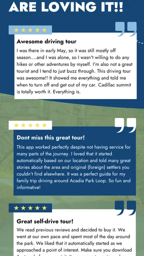
- GPS-triggered narration helps visitors notice landmarks while driving.
- Self-guided format lets you explore at your own pace without a fixed tour schedule.
- Provides background on Acadia’s scenery
- history
- and notable stops.
- Can be more affordable than booking a guided tour for a group.
Cons
- Audio content may not cover every trail
- viewpoint
- or attraction in the park.
- GPS accuracy can vary near cliffs
- dense forests
- or areas with weak signals.
- You may need to download tour content and maps before entering the park.
- Narration quality and pacing may not suit visitors seeking a live guide.
- Park road closures
- seasonal access
- and traffic can limit the suggested route.
FAQs for Acadia National Park GPS Tour
What is Acadia National Park GPS Tour, and how does it work?
Acadia National Park GPS Tour is a self-guided travel app designed to help visitors explore Acadia National Park at their own pace. After opening the tour, the app uses your phone’s location to provide route guidance, narrated information, and commentary about scenic viewpoints, roads, trails, history, and landmarks as you travel through the park. It is intended to complement, not replace, official park maps and signs.
Does Acadia National Park GPS Tour work without mobile data or Wi-Fi?
The tour is generally designed to be useful in areas with limited reception, but you should download the tour content and confirm that the required maps or audio files are available offline before entering the park. Cellular coverage can be inconsistent throughout Acadia, especially on remote roads and trails. Keep your phone charged, enable location services, and do not rely exclusively on the app for navigation or emergency information.
Is the Acadia National Park GPS Tour suitable for families and first-time visitors?
Yes, the app can be helpful for families, couples, and first-time visitors who want background information without joining a scheduled group tour. GPS-triggered narration can make drives more engaging, while the descriptions help explain Acadia’s scenery and cultural history. However, families should review the suggested stops in advance, since some viewpoints, trails, parking areas, and walking distances may not be suitable for young children or visitors with limited mobility.
Does the app include hiking directions, park maps, and information about important stops?
The tour typically focuses on guided sightseeing and location-based commentary, with information about notable roads, viewpoints, landmarks, and selected attractions. It may provide route context and stop suggestions, but it should not be treated as a complete hiking-navigation system. Before starting a trail, check official National Park Service information for current conditions, closures, difficulty ratings, weather warnings, parking rules, and safety recommendations.
What should I know about cost, privacy, and phone battery usage before downloading it?
Check the current listing on the Google Play Store or Apple App Store for the exact price, included tour content, optional purchases, and supported devices, because these details can change. A GPS tour may use significant battery power while location services and audio are active, so bring a power bank and download content beforehand. Also review the app’s permissions and privacy policy to understand how location and device data are handled.


